Following increasing threats and recent attacks on merchant vessels, and updated advice from industry associations, ChartWorld has released updates to its route networks and digital routing service. These updates are intended to support bridge teams‘ decision-making processes, by providing route planning flexibility within a recommended security corridor.
The industry associations of ICS, BIMCO, CLIA, INTERCARGO, IMCA, OCIMF and INTERTANKO have published a Security Bulletin and developed routing advice for the region of the Persian Gulf, Strait of Hormuz, and Sea of Oman. This advice aids passage planning as a reaction to the maritime threat environment in this area, and stresses that shipowners, operators, managers, and staff should regularly evaluate the risks to their ships, including navigation and collision avoidance, and plan routes accordingly.
For purposes of navigation, the coordinates in the security bulletin create a geographically bounded corridor connecting:
– The northern Persian Gulf to the Strait of Hormuz TSS.
– The Strait of Hormuz Traffic Separation Scheme south to a point off the coast of Muscat
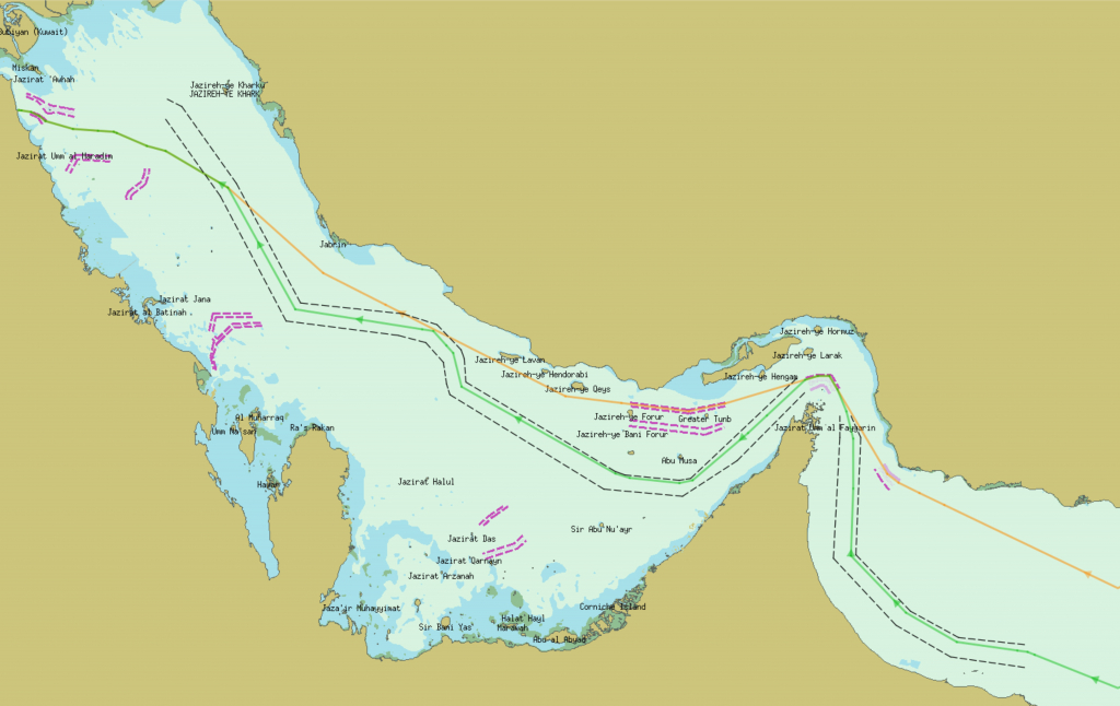
When combined, these sections form a transit corridor and is offered for consideration when planning the vessel’s route in/out of the region. The routing result, after the Route Network has been modified and the security corridor has been considered for the route calculation, can be seen below:

Black dotted line – Security Corridor; Orange line – Shortest Route; Green line – Recommended Route through Security Corridor
With the recent release of the Route Network, the navigator can now choose between the shortest route or a route inside the recommended security corridor by opening/closing the corresponding via-points. The route through the security corridor is chosen by default.
Given the advised safety parameters, it was fortunately not required to ‘limit’ the entire Persian Gulf, but there is still flexibility in routing and some space for optimization.